I had been dreading the Chesapeake and Delaware Canal ever since reading the warnings about small boats routinely being crushed into matchsticks by the heedless barges, tankers, and tugs that use the C&D as a handy short-cut between Philadelphia and Baltimore.
So dangerous was this canal that the Army Corps of Engineers supposedly maintained a real-time traffic map on the Internet, so small boat skippers could know ahead of time exactly which ship would be running them down.
 |
| C&D Canal |
Cleverly, I thought I would use this real-time map -- ha! -- to avoid getting run down.
Alas, when I tried to check the C&D traffic on the morning of my transit, I found the page was dead. I'd have to run the C&D blind, and hope for the best.
As I'm sure you've guessed by now, the C&D turned out to be a wide, placid canal with plenty of deep water. The day was still and hot (I broke out shorts and t-shirt for the first time in a couple of weeks.) And the only boat I saw was propelled by oars and manned by two boys in straw hats.
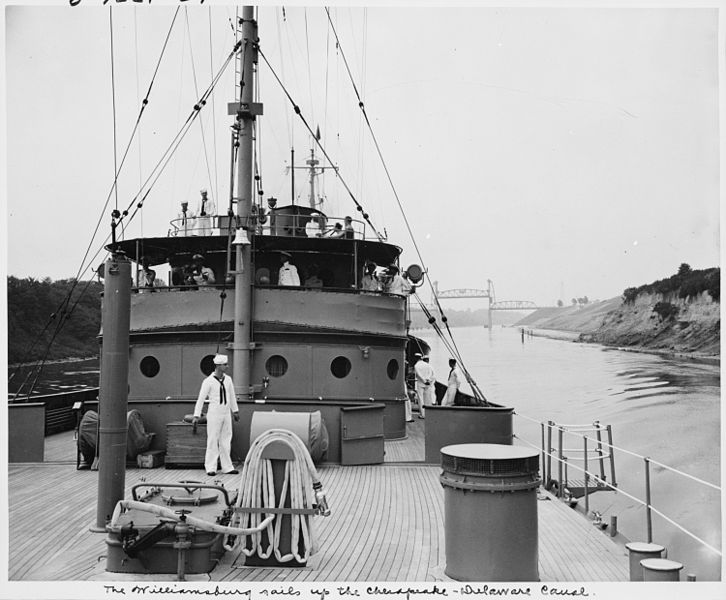 |
| President Truman's yacht on the C&D |
Okay, maybe I was lucky, but I wasn't complaining. And it turned out to be the last bit of good luck I'd see for awhile.
In fact, the guide books had their revenge as soon as I turned out of the C&D, onto the broad, gray Delaware.
Delaware Bay is notorious for being ugly, nasty, and seriously short on anchorages.
True, true, and true.
Since the C&D was such a breeze, I hit the Delaware in the early afternoon. There were only two anchoring options: 1). behind Reedy Island, about 5 miles south, and 2). the Cohansey River, another 15 miles or so down Delaware Bay. It was so early in the day, I wanted to try for Cohansey, which would leave me in good position to dash down the remainder of the Bay to Cape May.
Unfortunately, the Delaware is also notorious for it's currents. As I optimistically sailed for the Cohansey, I saw my speed over ground (SOG) gradually drop from 5.5 knots down to 1.7 knots as the upstream current took hold. My vision of reaching the Cohansey before dark faded with the current and I started worrying about how to shoot through the narrow, rocky passage into the Reedy Island anchorage in a 3+ knot cross current.
This anchorage is hemmed in by a stone sea wall, with just a small opening marked by two flags. By the time we reached it, the sun was sinking and the current was at full flood. The stone wall was completely underwater, with just the red and green markers to show where the opening might be. The current was so strong, we had to go through the opening crabwise -- i.e., practically sideways -- to not get dashed upon the rocks.
However, by now I knew how the Blue Moon handled in a current, and we went straight through the center of the gap, and into the (somewhat) protected waters behind Reedy Island.
I anchored close to the shore to get as much protection from the wind as possible. The current behind the island was still fierce, so I put down my 35 lb anchor with plenty of scope. The first and only time I would anchor in the State of Delaware. Across the river, I had my first glimpse of the New Jersey shore.
Yes, it was windy. Yes, the current was scary fast. And yes, the weather had suddenly taken a chilly turn. But what really worried me that night was giant, mutant crayfish...
 | |
| The view from Reedy Island Anchorage... Why was the water so abnormally warm? photo jalmberg |
I scattered tacks on the deck, closed the hatches, and went to my bunk with an uneasy feeling...

Next Episode: Delaware Challenge
Smile , :) ........
ReplyDeleteKeeping track of the 'Big Bruisers' is made easier by an AIS display, but the cost, complication and need for extra vhf antennas/cables makes it hard to justify.
Last Year, Standard Horizon released a VHF radio with integrated AIS receiver and display that sells for about $350 ($309-$399). Plug it into your existing antenna and 12VDC power and your have a VHF and AIS display and will give all the normal AIS data like COG, SOG, CPA, Name Vessel, Destination, DSC direct call to selected vessel, etc... !!!
http://www.standardhorizon.com/indexVS.cfm?cmd=DisplayProducts&ProdCatID=83&encProdID=F858763BB81027701141A0167DE2A031
Godzirra??? GODZIRRA!!!
ReplyDeleteWhy no new posts?
ReplyDeleteCome on! You're almost home!
ReplyDeleteSorry to leave you hanging, folks, but all sorts of chose & computer adventures have kept me from posting. New update tomorrow, I promise!
ReplyDeleteUh, that should be boat & computer adventures. Good spell checking, google'
ReplyDeleteShades of Captain Slocum! You made me laugh with that tack bit.
ReplyDelete